South Carolina is a Southern state of 46 counties, with Columbia as its capital. These five free printable maps cover its outline, its largest cities, its counties and the two states it borders, with an answer key for the neighbors quiz.
To download a single map, click its image and it opens as a one-page PDF. To get all five maps together, plus the quiz answer key, press the Download all 5 South Carolina maps button below the last map.
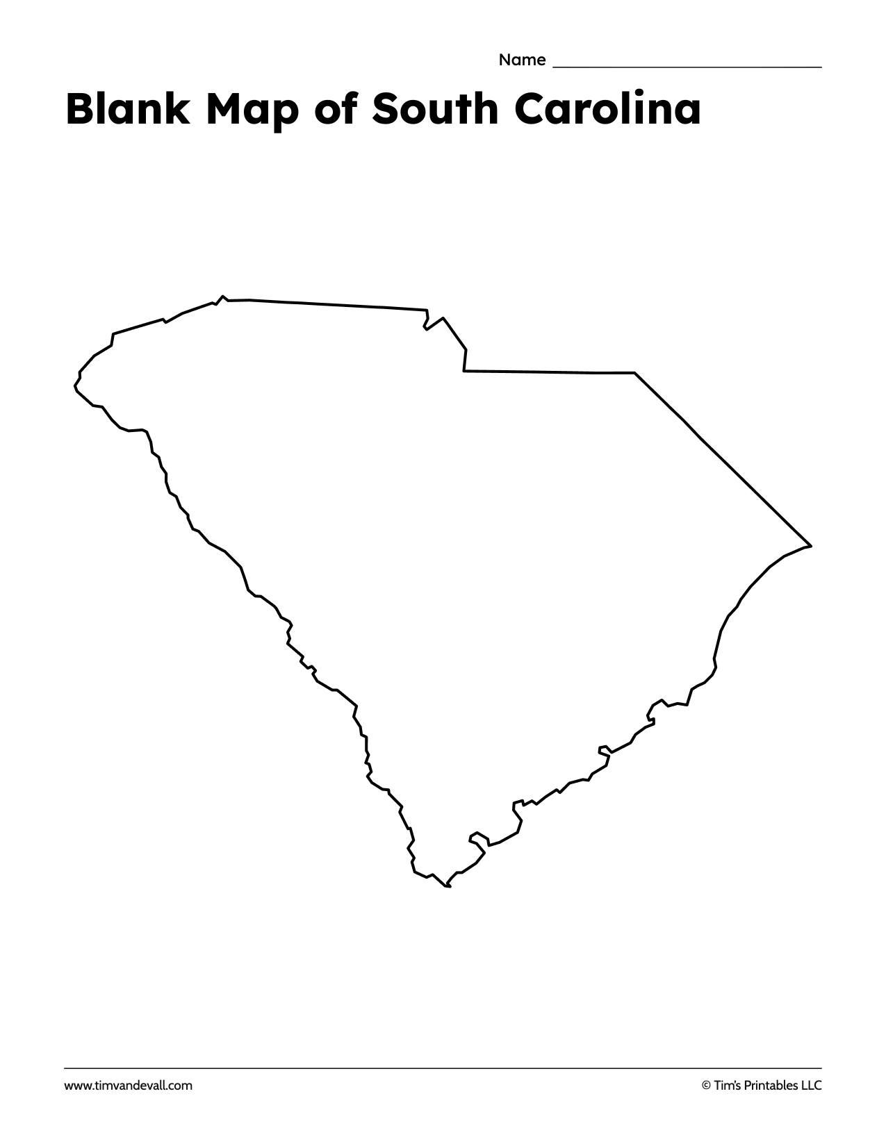
Blank Map of South Carolina
The state outline on its own, for labeling, coloring or tracing.
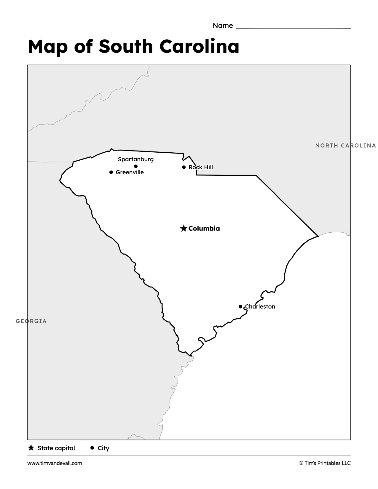
Labeled Map of South Carolina
Columbia, the capital, is marked with a star. Charleston, Greenville, Spartanburg and Rock Hill are marked with dots, and the neighboring states are named around the edge.
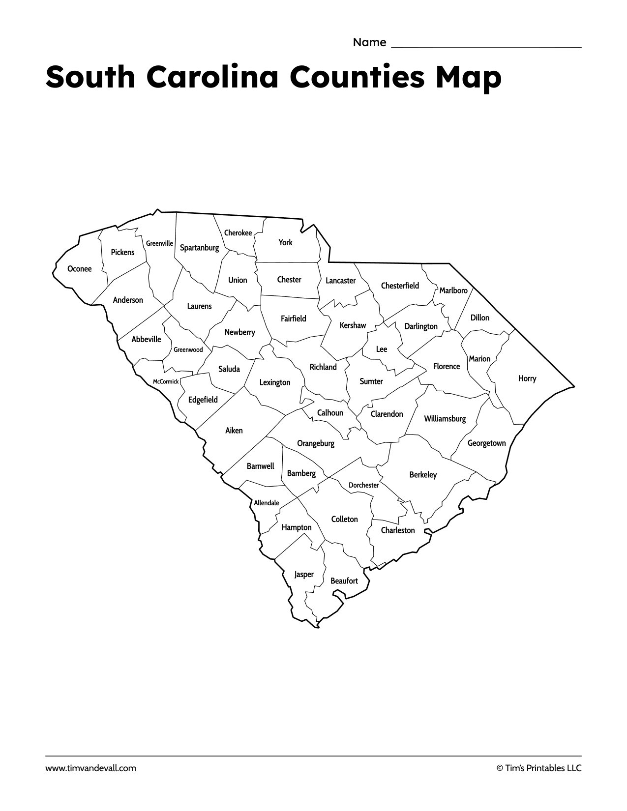
South Carolina County Map
All 46 counties drawn and named.
Neighbors of South Carolina Quiz
Two numbered circles, one on each bordering state. Students write the names on the lines. The answer key is the last page of the PDF.

Where Is South Carolina?
South Carolina shaded on a map of the United States.

South Carolina Facts
| Capital | Columbia |
| Largest city | Charleston |
| Population | 5,118,425 (2020 Census) |
| Area | 32,020 sq mi (82,931 km²) |
| Counties | 46 |
| Statehood | May 23, 1788 (8th state) |
| Nickname | The Palmetto State |
| Motto | Dum spiro spero |
| Highest point | Sassafras Mountain, 3,560 ft (1,085 m) |
| Borders | Georgia, North Carolina; Atlantic Ocean |
Sources: US Census Bureau (2020 Census, cartographic boundary files), Wikidata.
Largest Cities in South Carolina
| City | Population (2020) |
|---|---|
| Charleston | 150,227 |
| Columbia | 136,632 |
| North Charleston | 114,852 |
| Mount Pleasant | 90,801 |
| Rock Hill | 74,372 |
| Greenville | 70,720 |
South Carolina’s 46 Counties and County Seats
The largest county by area is Berkeley County. The most populous is Greenville County, home to Greenville. Every county below is drawn on the county map.
| County | County seat | Population (2020) |
|---|---|---|
| Abbeville | Abbeville | 24,295 |
| Aiken | Aiken | 168,808 |
| Allendale | Allendale | 8,039 |
| Anderson | Anderson | 203,718 |
| Bamberg | Bamberg | 13,311 |
| Barnwell | Barnwell | 20,589 |
| Beaufort | Beaufort | 187,117 |
| Berkeley | Moncks Corner | 229,861 |
| Calhoun | St. Matthews | 14,119 |
| Charleston | Charleston | 408,235 |
| Cherokee | Gaffney | 56,216 |
| Chester | Chester | 32,294 |
| Chesterfield | Chesterfield | 43,273 |
| Clarendon | Manning | 31,144 |
| Colleton | Walterboro | 38,604 |
| Darlington | Darlington | 62,905 |
| Dillon | Dillon | 28,292 |
| Dorchester | St. George | 161,540 |
| Edgefield | Edgefield | 25,657 |
| Fairfield | Winnsboro | 20,948 |
| Florence | Florence | 137,059 |
| Georgetown | Georgetown | 63,404 |
| Greenville | Greenville | 525,534 |
| Greenwood | Greenwood | 69,351 |
| Hampton | Hampton | 18,561 |
| Horry | Conway | 351,029 |
| Jasper | Ridgeland | 28,791 |
| Kershaw | Camden | 65,403 |
| Lancaster | Lancaster | 96,016 |
| Laurens | Laurens | 67,539 |
| Lee | Bishopville | 16,531 |
| Lexington | Lexington | 293,991 |
| Marion | Marion | 29,183 |
| Marlboro | Bennettsville | 26,667 |
| McCormick | McCormick | 9,526 |
| Newberry | Newberry | 37,719 |
| Oconee | Walhalla | 78,607 |
| Orangeburg | Orangeburg | 84,223 |
| Pickens | Pickens | 131,404 |
| Richland | Columbia | 416,147 |
| Saluda | Saluda | 18,862 |
| Spartanburg | Spartanburg | 327,997 |
| Sumter | Sumter | 107,456 |
| Union | Union | 27,244 |
| Williamsburg | Kingstree | 31,026 |
| York | York | 282,090 |
States That Border South Carolina
South Carolina shares land borders with two states: Georgia to the southwest and North Carolina to the north. The Savannah River forms most of the border with Georgia. It has a coastline on the Atlantic Ocean.
For the whole country, see the blank United States map with states, or browse all printable maps.
Connect the dots: draw the outline of South Carolina with the free South Carolina dot-to-dot, in color and black and white.
About These Maps
These maps are made by Tim van de Vall for Tim’s Printables. The outlines come from US Census Bureau boundary files, simplified so the lines print cleanly, and the facts and figures come from the 2020 Census and Wikidata. Every sheet is sized for US Letter paper and is free to print for home and classroom use.